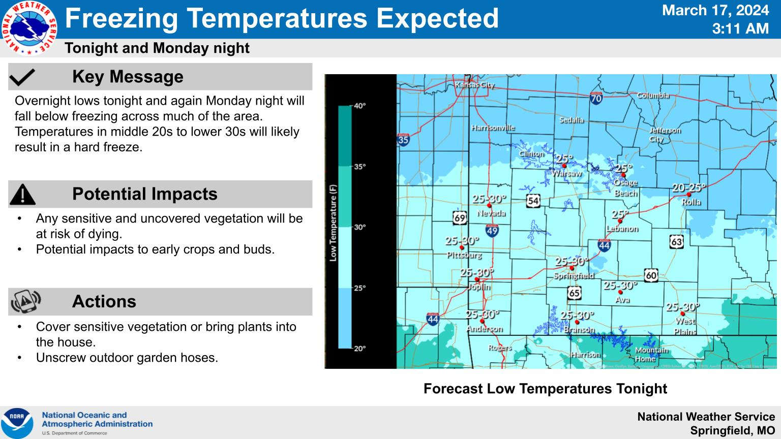
With the official start of Spring happening on Tuesday, residents in the Lakes Area will get a final cold blast on the last full day of Winter.
A cold front moving through the region is dropping temperatures to overnight lows in the upper 20s going into Monday with daytime highs only in the 40s Monday afternoon. A hard freeze is expected for much of the region overnight into Monday. While Monday will be sunny, strong winds from the northwest gusting to 25 MPH will keep conditions brisk during the day. After another cold night Monday, temperatures rebound on Tuesday to high's back in the 60s before the official arrival of Spring Tuesday evening.
The National Weather Service has issued a Freeze Warning for parts of northern Arkansas including Harrison and Boone County as well Marion, Newton, and Searcy Counties for early Monday morning with a Freeze Watch in effect for early Tuesday.
In addition to the cold temperatures, low humidity and high winds will present an elevated fire risk for the region through Tuesday.
 Juneteenth Federal Holiday Closes Government Offices, Financial Institutions
 Have Recent Rains Impacted the Drought Levels?
 Which Table Rock Lake Swim Beaches Have Reopened?
 How are E. Coli Levels Impacting the Finley River?
 Branson Board Approves Historic Downtown CID Agreement, Postpones Public Comment Revision


