Today could be the last day of 80 plus degree temperatures in the Lakes Region for a while.
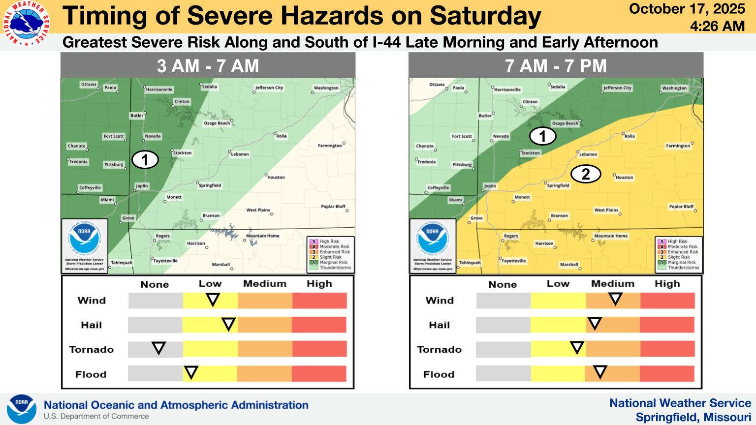
The National Weather Service says a frontal system will push through the area beginning early Saturday morning, bringing with it a slight chance of severe thunderstorms. Strong winds and hail are the primary threats with the storms. Some areas could see heavy rain with an inch to an inch and half possible.
The stormy Saturday will bring much cooler temperatures to the Lakes Region with Sunday highs only in the 60s before settling into the 70s next week. Lows are expected in the upper 40s into the 50s.
 Rainy Weekend Ahead for the Lakes Region
 H2Ozarks Among Groups Benefitting from Latest Grants from Arkansas Department of Agriculture
 Traffic Crash in Boone County Kills One, Injures Another
 Juneteenth Federal Holiday Closes Government Offices, Financial Institutions
 Have Recent Rains Impacted the Drought Levels?


