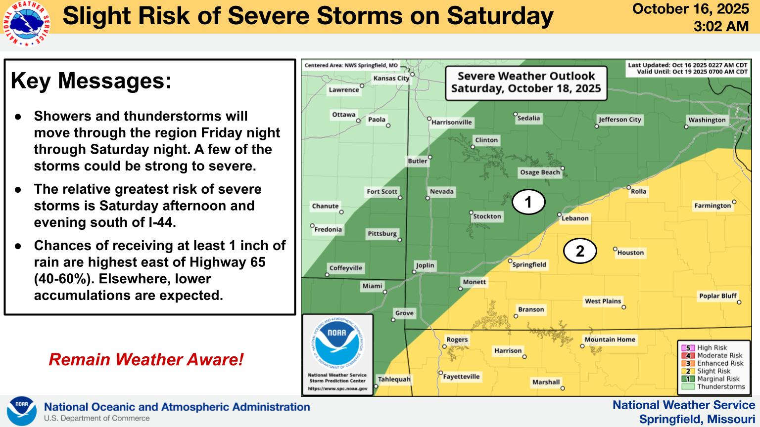
The National Weather Service says that the Lakes Region is at a Level 2, or Slight Risk for Severe Thunderstorms to move through the region on Saturday.
Forecasters indicate that a frontal system will approach the region on Friday and will arrive early Saturday morning causing rain chances to increase. While forecasters have not specified the type of severe weather expected, they do say areas east of Highway 65 could see the most rainfall.
After the frontal passage Saturday, temperatures are expected to be closer to normal for this time of year with highs in the 70s and lows in the upper 40s to low 50s.
 Branson Schools Announces New Executive Director of Operations
 Pioneering Quality in the Steel Industry
 Can a Contractor Take Over Your Home
 Frozen Pipes, Hot Water Heaters, and Dishwasher Mishaps
 Choosing the Right Trailer: A Comprehensive Guide


