

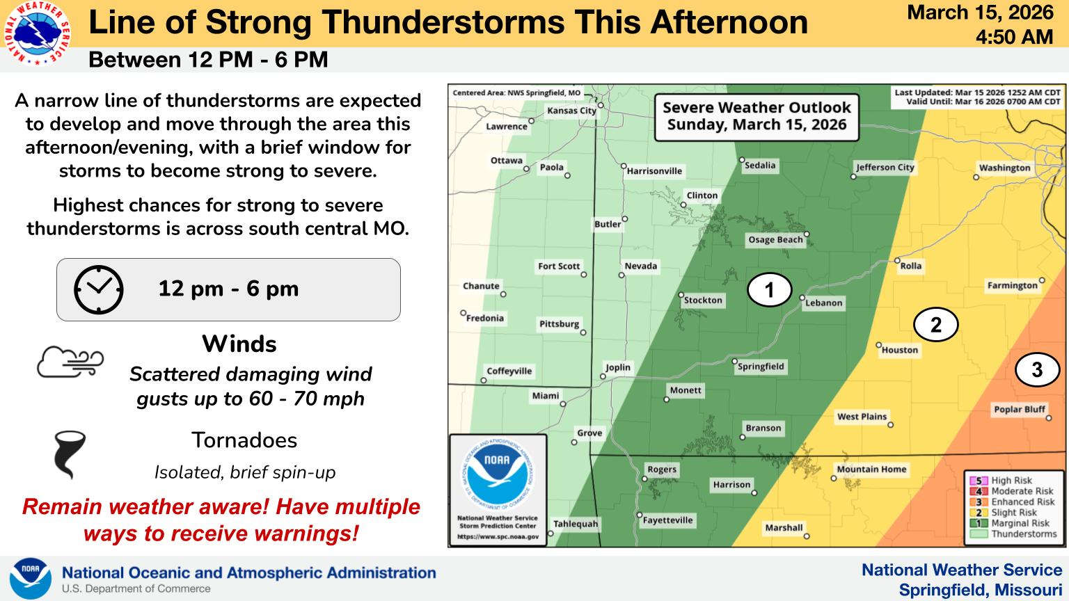
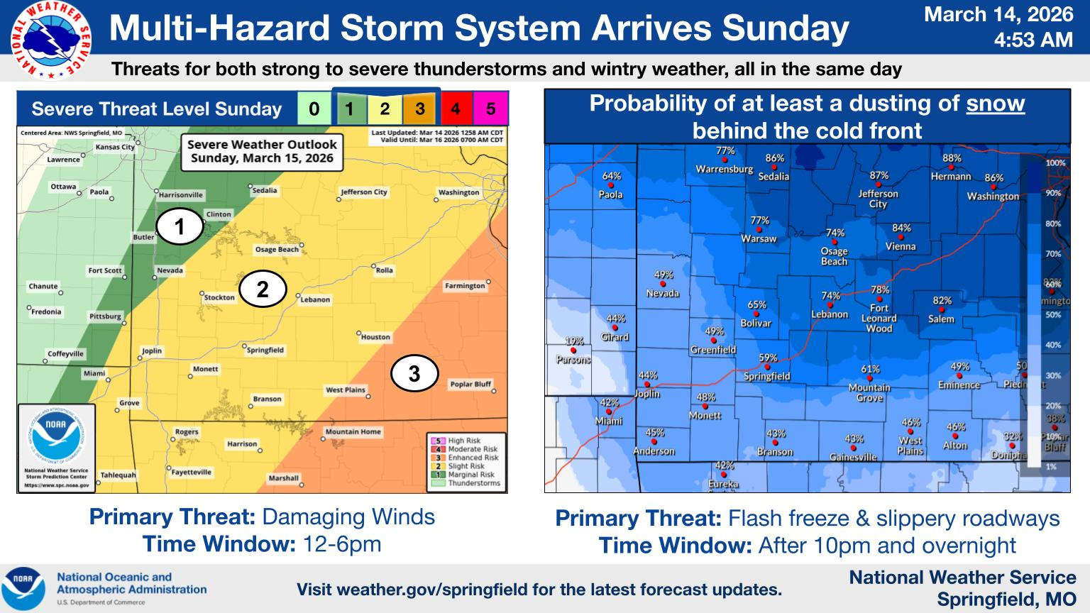
While precipitation chances have dropped overall, two major weather threats remain as the front that will drop temperatures 50 degrees today approaches the Ozarks.
According to information released this morning from the National Weather Service, strong winds and potential flash freezing are the biggest threats during the day going into Monday.
Winds pick up this morning out of the south then will begin shifting early this afternoon eventually to the northwest with gusts between 35-45 MPH. Wind Advisories are in effect for all of the Ozarks through the day going into Monday.
Showers and thunderstorms will develop as the front moves through, though forecasters have dropped the severe weather risk to the marginal to slight range. Scattered strong storms can still be expected as the front moves through mid-afternoon.
Forecasters have greatly reduced the chance of winter precipitation, with only snow flurries expected in some areas. Forecasters still have concerns over the potential for flash freezing on some surfaces as temperatures drop rapidly below freezing tonight. Drivers need to be cautious, especially on bridges for possible slick spots developing as do pedestrians on sidewalks.
After temperatures get to the mid 60s this afternoon, the front will drop readings all the way down to the teens by the end of the day. A Freeze Warning is in effect for north central Arkansas including Boone, Marion, and Newton Counties for potential damage to early season crops and foliage.
Monday will keep winter temperatures with highs only getting into the 30s and lows back to the teens before a quick warm-up begins which sees temperatures back into the 70s and 80s by Thursday.


 MDC Works with State, Federal Agencies to Improve Fish Habitat at Table Rock Lake
 Stone County Sheriff Warns of Another Scam
 Voliva Moves Up to Take Top Spot at Forsyth Elementary School
 A Full Range of Weather This Weekend in the Ozarks
 Spring Fling Event Coming to Downtown Branson