1:00 PM UPDATE: The National Weather Service has issued a Tornado Watch for areas east of the Highway 65 Corridor including Taney County and the Branson Area as well as Green and Christian Counties and the metro Springfield Area. The watch is in effect until 9:00 this evening. The watch does not include Arkansas currently but areas east of 65 in both Arkansas and Missouri are now at a Level 3 or Enhanced Chance of Storms.
Original Story:
The Lakes Region did see some severe weather early this morning at the end of a string of storms that ripped through southwest Missouri.
A Supercell Thunderstorm formed over southeast Kansas eventually leading to the formation of a tornado that moved into Missouri between Carl Junction and Joplin. The cell had an east-southeast path and though the tornado lifted shortly after getting into Missouri, the storm continued on that path leading to Severe Thunderstorm Warnings for northern parts of Barry, Stone, and Taney Counties before the cell dropped below severe levels as it moved further east. No storm damage was reported in the Lakes Region.
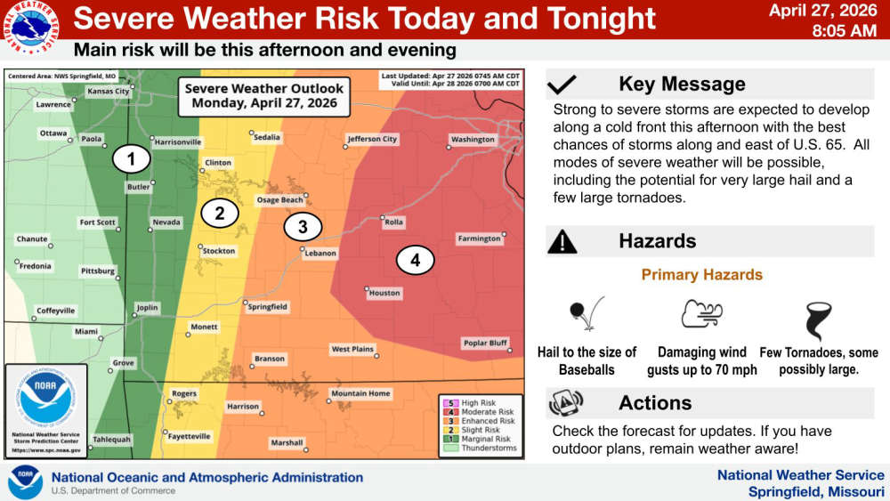
Another round of showers and thunderstorms are possible today with the Lakes Region seeing the formation of storms that will get stronger as they move east. South central Missouri is at an Enhanced Risk for Severe Weather today with the Lakes Region holding at a Marginal to Slight Risk.
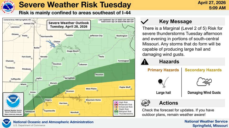
Another wave of storms are possible on Tuesday with the major threat shifting into Arkansas. The Lakes Region will again be at a Slight Severe Risk.
 Rainy Weekend Ahead for the Lakes Region
 H2Ozarks Among Groups Benefitting from Latest Grants from Arkansas Department of Agriculture
 Traffic Crash in Boone County Kills One, Injures Another
 Juneteenth Federal Holiday Closes Government Offices, Financial Institutions
 Have Recent Rains Impacted the Drought Levels?


