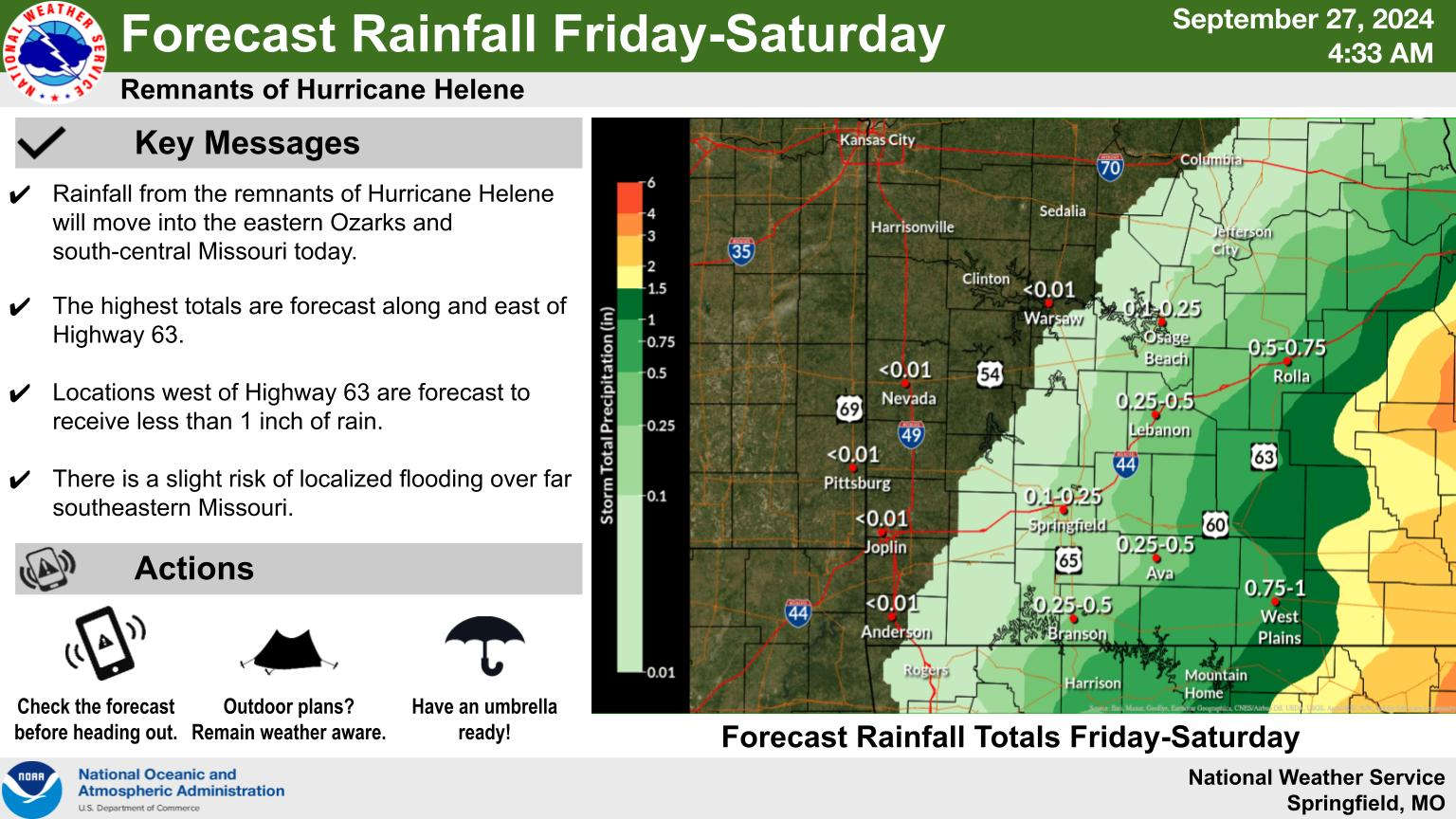
Hurricane Helene hit landfall in the Gulf Coast of Florida overnight bringing heavy rain and winds more than 140 MPH.
Now a tropical storm, Helene is moving westward and will have some impacts in the Lakes Region. Forecasters with the National Weather Service and Ozarks First indicate most of the rain will fall east of a Camdenton/Springfield/Eureka Springs line with amounts generally remaining under an inch. West of that line, little if any rain is expected.
Increased winds will impact the area today with wind gusts up to 35 MPH possible through the day and into the evening.
While rain will move out late tonight, clouds will linger through Saturday before clearing up on Sunday. Temperatures will stay in the 70s Saturday with some 80s possible Sunday.
 Branson Schools Announces New Executive Director of Operations
 Pioneering Quality in the Steel Industry
 Can a Contractor Take Over Your Home
 Frozen Pipes, Hot Water Heaters, and Dishwasher Mishaps
 Choosing the Right Trailer: A Comprehensive Guide


