An active weather week in the Lakes Region includes the possibilities of severe thunderstorms along with heavy rain followed by winter precipitation later in the week.
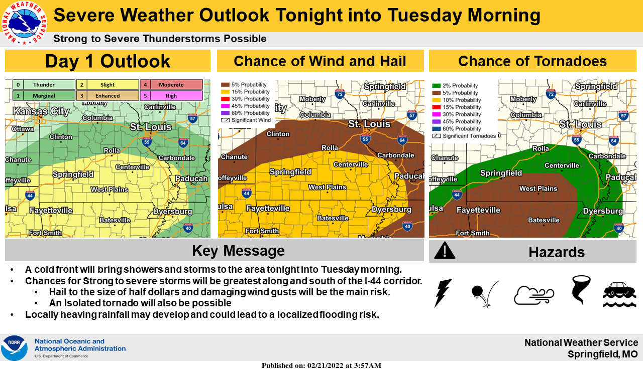
A warm and windy will be followed tonight with heavy rain moving in and a chance of strong to severe thunderstorms. A Flood Watch is in effect for tonight into Tuesday morning for the Arkansas Lakes Region Counties of Boone, Carroll, Madison, Marion, Newton, and Searcy and for the Missouri counties of Taney, Stone, Barry, and Ozark. Up to an inch and a half of rain is predicted in the region with some higher amounts possible especially in northern Arkansas.
After the rain moves out Tuesday, colder air enters the region with highs in the 30's and lows in 20's. The next wave of precipitation comes in Wednesday afternoon and starts as rain but is expected to change over to a mixture of freezing rain, sleet, and snow during the evening and continue through the day Thursday.
The National Weather Service says that the timing, amounts, and types of precipitation for Wednesday and Thursday is still uncertain but does expect some winter weather impacts on travel Wednesday night through Thursday.
 Rainy Weekend Ahead for the Lakes Region
 H2Ozarks Among Groups Benefitting from Latest Grants from Arkansas Department of Agriculture
 Traffic Crash in Boone County Kills One, Injures Another
 Juneteenth Federal Holiday Closes Government Offices, Financial Institutions
 Have Recent Rains Impacted the Drought Levels?


