

The Lakes Region begins the weekend warm and will end with a final blast of winter before the official beginning of spring later in the week.
Today is quiet with highs in the upper 70s with winds picking up later gusting to around 20 MPH.
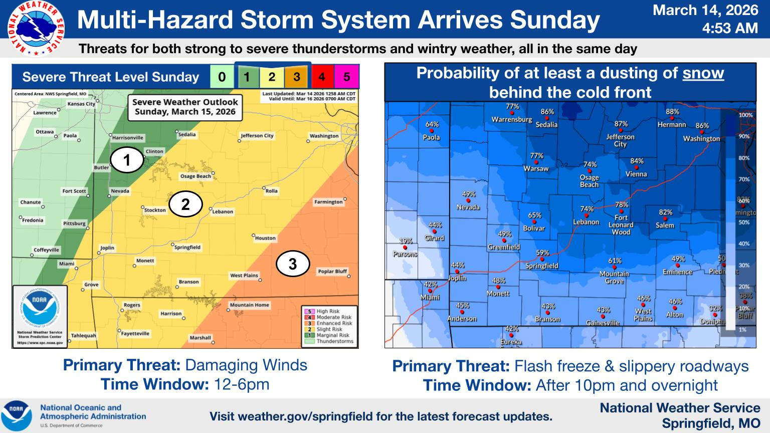
Sunday will begin warm with winds picking up during the morning and gusting to around 40 MPH before shifting to the north early afternoon bringing in the colder air. Temperatures will get into the 60s before tumbling through the rest of the days ending up in the teens overnight.
Rain chances begin Sunday morning with thunderstorms possible by afternoon. There is a slight risk of severe storms during the afternoon with strong winds the primary threat.
Once the temperature drops, rain may convert to sleet and snow briefly before ending by the end of the day. While no major accumulations are expected, the strong winds and precipitation could cause some minor travel impacts.
Monday will be a winter like day with highs only in the 30s and lows in the teens before a quick warm-up begins which will see temperatures back in the 80s by Friday, the first day of Spring.


 Spring Fling Event Coming to Downtown Branson
 Silver Dollar City Season 66 Opens Today
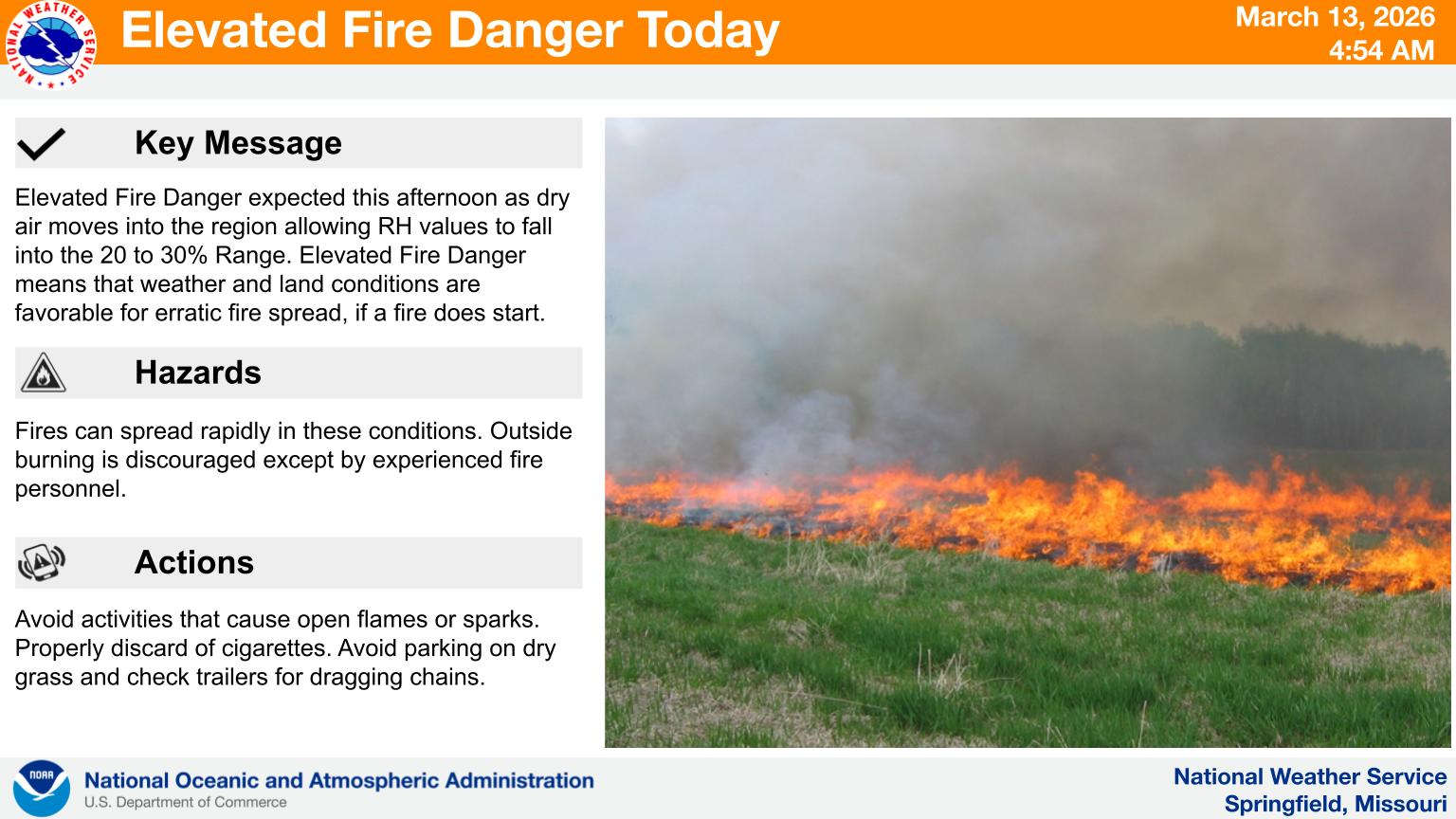 Fire Danger Today, Extreme Temperatures Expected over Next Week
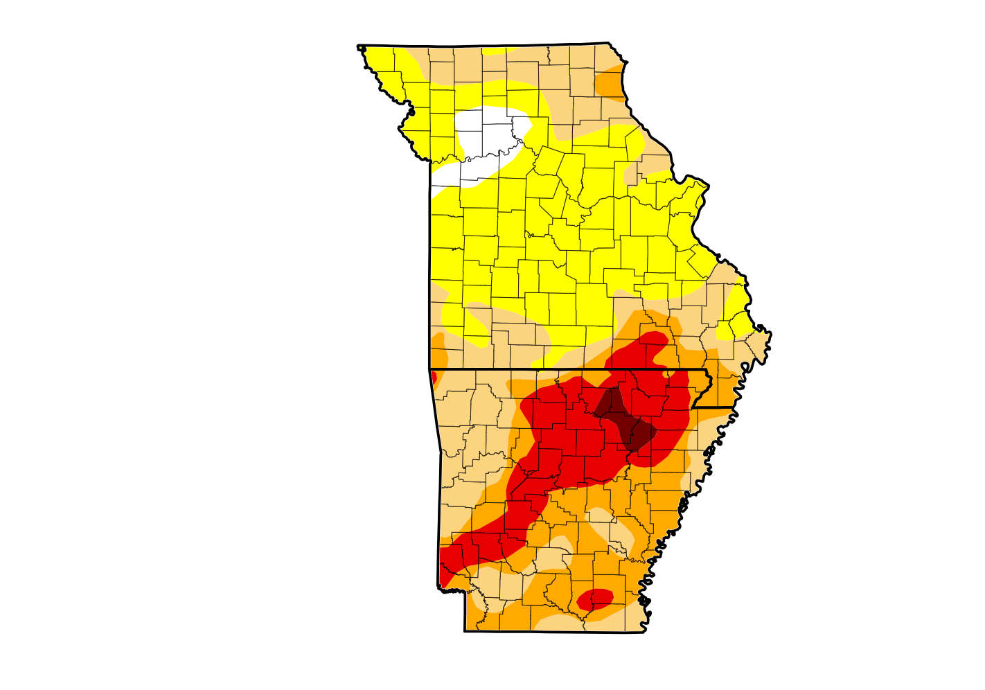 Rain Reduces Drought for Parts of the Lakes Region
 Woman Sentenced in 2025 Kimberling City Apartment Fire