


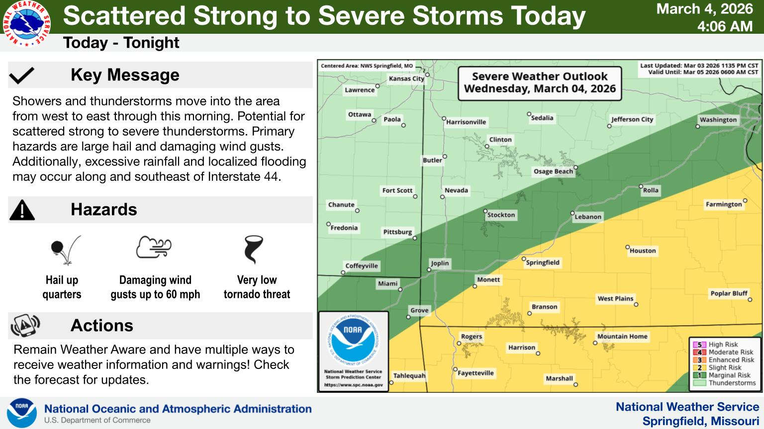
The National Weather Service increases the Severe Weather Threat for Wednesday for the Lakes Region.
According to the latest prediction released this morning, most of the region is now at a Level 2 or Slight Risk for Severe Storms. A cold front will move through the region Wednesday afternoon and evening bringing the chance for severe thunderstorms with hail and damaging wind the primary threats. Locally heavy rainfall and isolated flooding will also be possible.
There is fog this morning and some isolated showers are possible, but temperatures are expected to surge into the upper 70s this afternoon creating the potential for instability.
More severe weather is possible on Friday with rain in the forecast for the rest of the week.


 Stone County Hosts Sessions to Hear Planning and Zoning Input
 Severe Storms in Forecast for Today, Friday
 Branson Woman Facing Charges in Infant Death
 40 Hours of Bowling for Fallen Deputies
 Harrison Voters Split on Sales Tax Renewals, Other Election Results