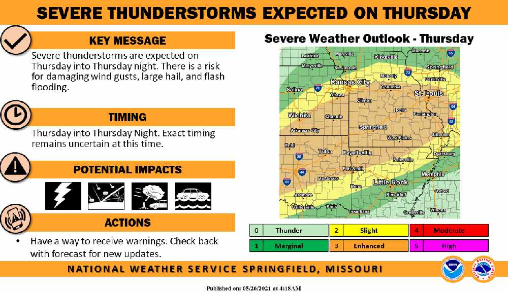
Much of Northwest Arkansas and Southwest Missouri could see a round of Severe Weather on Thursday.
Forecasters for the National Weather Service say that Thunderstorm development will build on Thursday afternoon into the evening with Damaging Winds, Large Hail, and Flash Flooding the biggest risks.
Much of the region will see a break in the rain today with just chances of scattered showers before Thursday’s Severe Potential. Forecasters say much of the upcoming Memorial Day Weekend will be dry with a chance of some showers redeveloping on Monday.
 Rainy Weekend Ahead for the Lakes Region
 H2Ozarks Among Groups Benefitting from Latest Grants from Arkansas Department of Agriculture
 Traffic Crash in Boone County Kills One, Injures Another
 Juneteenth Federal Holiday Closes Government Offices, Financial Institutions
 Have Recent Rains Impacted the Drought Levels?


