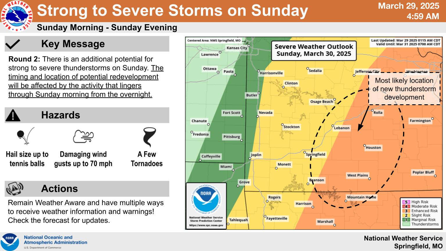
Showers and thunderstorms will develop in two waves over the weekend.
The latest information released from the National Weather Service shows the first wave will develop late tonight with the potential of large hail the main threat. The region has been upgraded to a marginal to slight risk for tonight into Sunday morning.
A second wave is expected to develop Sunday afternoon with the Lakes Region in a slight to enhanced risk of storms. The locations of the storms will depend on how quickly the first wave of storms moves out. The quicker those storms dissipate, the more likely for severe weather to develop later.
Temperatures will be in the 70s through the weekend then drop to around 60 for the Monday afternoon high.


 Sporting Events Dominate The Opening Weekend of Spring
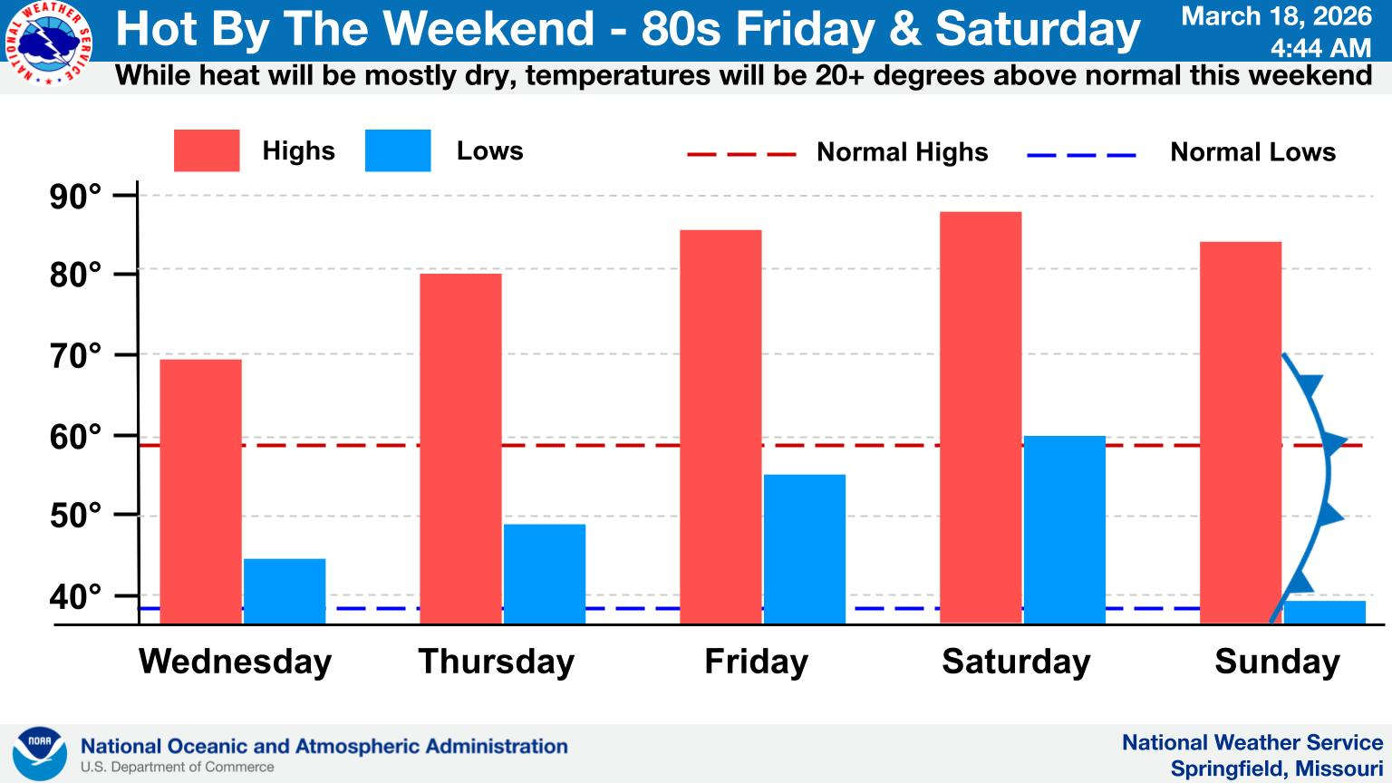 Temperatures Move Up The Rest of the Week
 Impeachment Process of Forsyth Mayor Continues
 NCCAA National Basketball Tournament Begins Wednesday
 Eureka Springs City Council Member Arrested For Incidents in 2025