
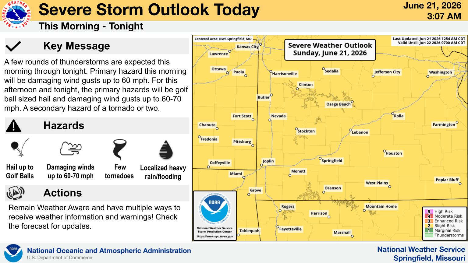
The Lakes Region was spared major severe weather during the passage of a frontal system Sunday evening though some areas did see some strong storms.
A storm cell moved along the Missouri-Arkansas Boarder that did trigger a Severe Thunderstorm Warning for southern Barry, Stone, and Taney Counties in Missouri and later for parts of Northern Boone and Marion Counties in Arkansas. Law Enforcement reported 1 inch diameter hail in the Omaha area and later as the stormed moved into north central Arkansas, 70 MPH Wind Gust.
A tornado was reported by radar in parts of Douglas and Webster Counties with several trees reported down around the Marshfield area.
Heavy rain was a part of this system, especially on Saturday with flooding conditions in parts of the Ozarks. Highway 97 at Stotts City in Lawrence County remains closed this morning due to high water.
Two waves of cooler temperatures are expected this week with 60 degree temperatures today going up into the 70s on Tuesday then after another frontal system brings rain, temperatures will drop into the 50s for highs Thursday and Friday.
 Flood Watch in Effect, Heavy Rain and Storms Possible
 Branson Police Department Brings Back Motorcycle Unit
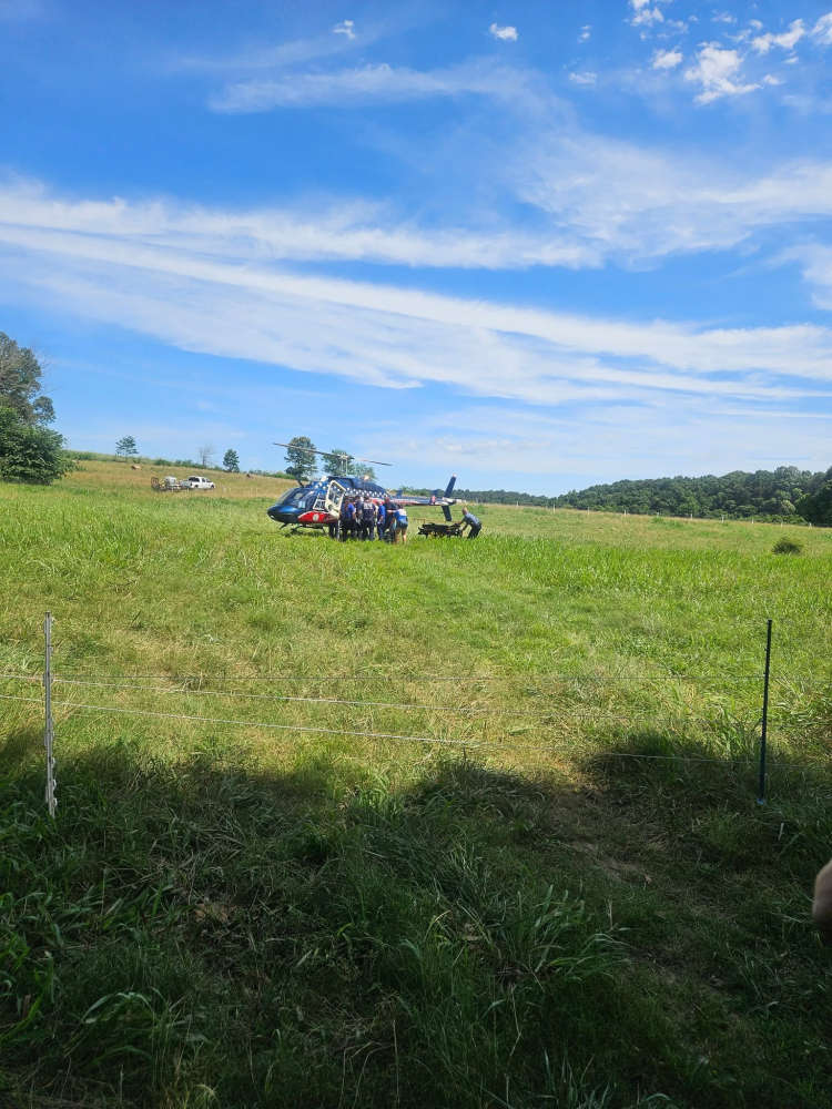 Multiple Agencies Respond to Juvenile Trapped in Water
 Rainy Weekend Ahead for the Lakes Region
 H2Ozarks Among Groups Benefitting from Latest Grants from Arkansas Department of Agriculture


