While Round One of Winter Storm Landon brought mainly rain, freezing rain, and sleet to the region, weather forecasters expect Round Two to have a major snow impact.
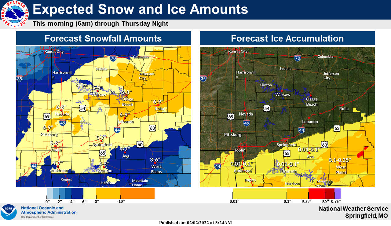
Doug Cramer with the National Weather Service Office in Springfield says during an interview Wednesday on KRZK's "Ozarks Now" program that snow will begin late afternoon/early evening in the region with sleet mixed in to begin with, but eventually all snow leaving a total accumulation of four to eight inches by the time it ends Thursday afternoon. While the ice amounts will be lower than was early expected, the accumulations that did happen Wednesday morning in addition to higher winds can make travel very tough this evening into Thursday morning. Some higher ice accumulations could still occur in the higher elevations of Northern Arkansas.
Cramer added that people who do have to travel be prepared to be stranded by having extra supplies in order to stay warm until help arrives and also says that when snowfall hits, individuals need to be careful not to overdo it when shoveling snow. Cramer says an increase in cardiac issues often occur during heavy snow.
The Winter Storm Warning will remain in effect for all of the Lakes Region through the day on Thursday.
The complete interview with Doug Cramer from Ozarks Now can be heard below:
 Traffic Crash in Boone County Kills One, Injures Another
 Juneteenth Federal Holiday Closes Government Offices, Financial Institutions
 Have Recent Rains Impacted the Drought Levels?
 Which Table Rock Lake Swim Beaches Have Reopened?
 How are E. Coli Levels Impacting the Finley River?


