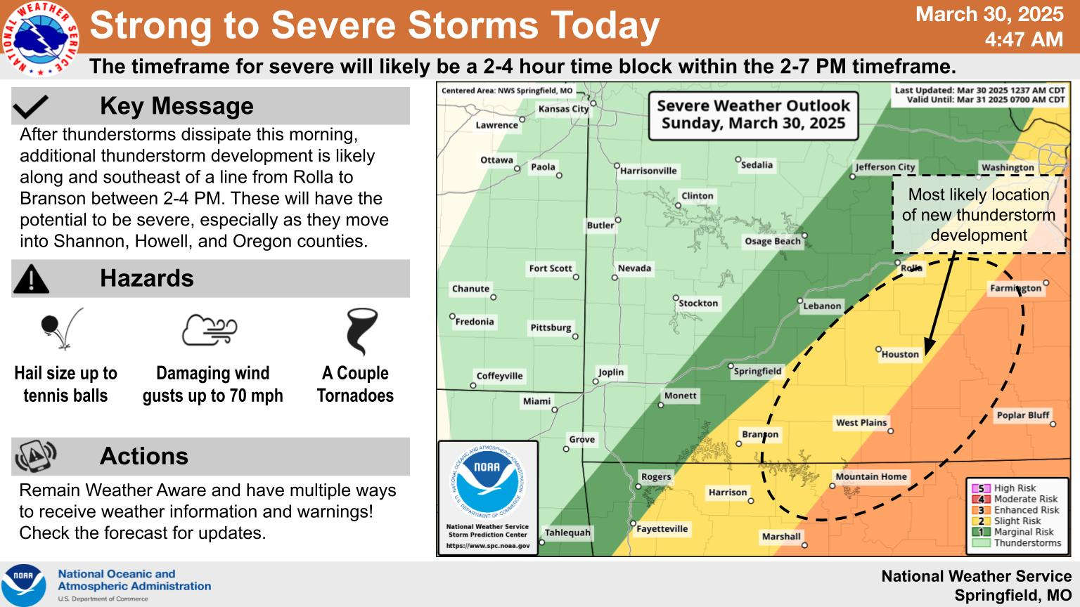
The National Weather Service has not eliminated the chance of severe weather for the Lakes Region but has shifted the primary target area east.
Information Sunday morning released by the NWS Shows the lakes region with a Slight Risk of Severe Weather with redevelopment of thunderstorms after the first round moved through early this morning. While the threat of storm development is still possible, projections show the strongest storm development to be southeast of a Rolla-Branson-Harrison line with the biggest threat in southeast Missouri and northeast Arkansas.
The first round of storms did lead to several Severe Thunderstorm Warnings for parts of the Lakes Region but storms weakened as they moved through the region.


 Sporting Events Dominate The Opening Weekend of Spring
 Temperatures Move Up The Rest of the Week
 Impeachment Process of Forsyth Mayor Continues
 NCCAA National Basketball Tournament Begins Wednesday
 Eureka Springs City Council Member Arrested For Incidents in 2025