
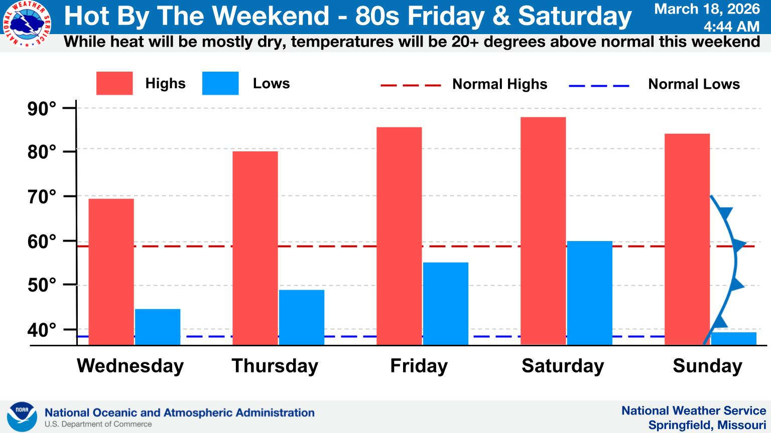
Today's first day of winter will be the coolest of the week according to the National Weather Service.
Today's highs will be in the 50s, lows in the 30s which is just the start of a warm-up that will go all the way through Christmas Week. Today will also see elevated fire risk conditions with low humidity and winds gusting over 20 MPH.
Temperatures will get into the 60s on Monday then reach the 70s by Tuesday and stay there most of the week, with nightly lows primarily in the upper 40s to mid 50s.
No rain is currently in the forecast for the Lakes Region, which has seen an expansion of drought conditions over the last two weeks.


 Sporting Events Dominate The Opening Weekend of Spring
 Temperatures Move Up The Rest of the Week
 Impeachment Process of Forsyth Mayor Continues
 NCCAA National Basketball Tournament Begins Wednesday
 Eureka Springs City Council Member Arrested For Incidents in 2025